About El Niño and La Niña
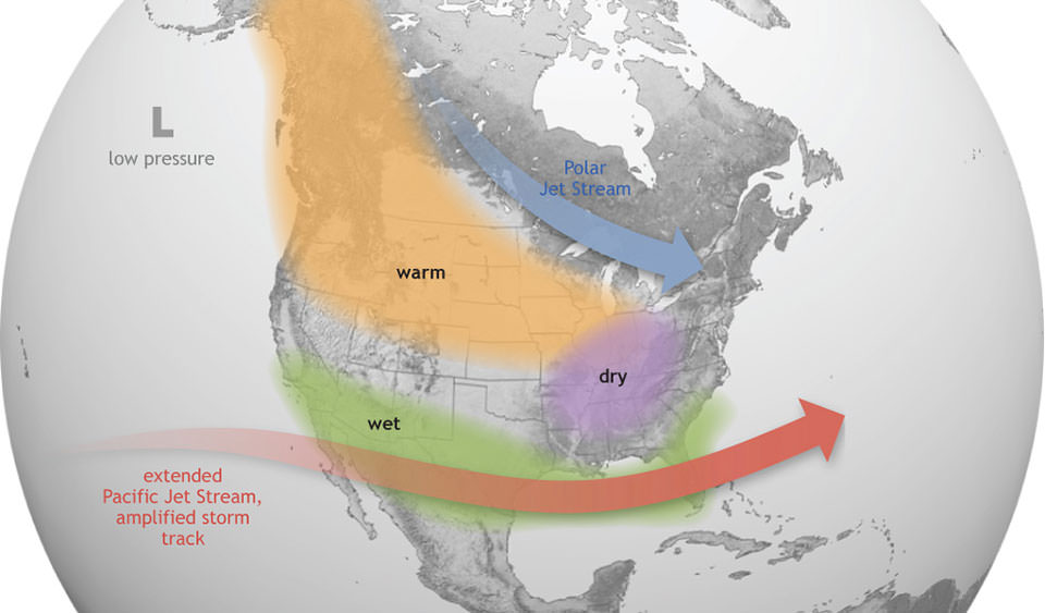
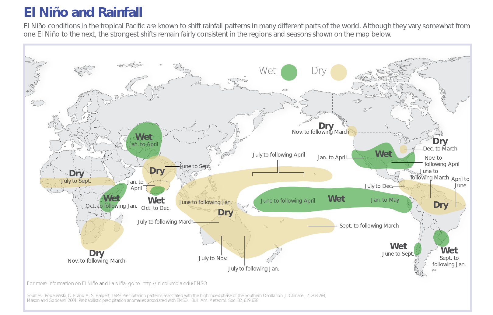
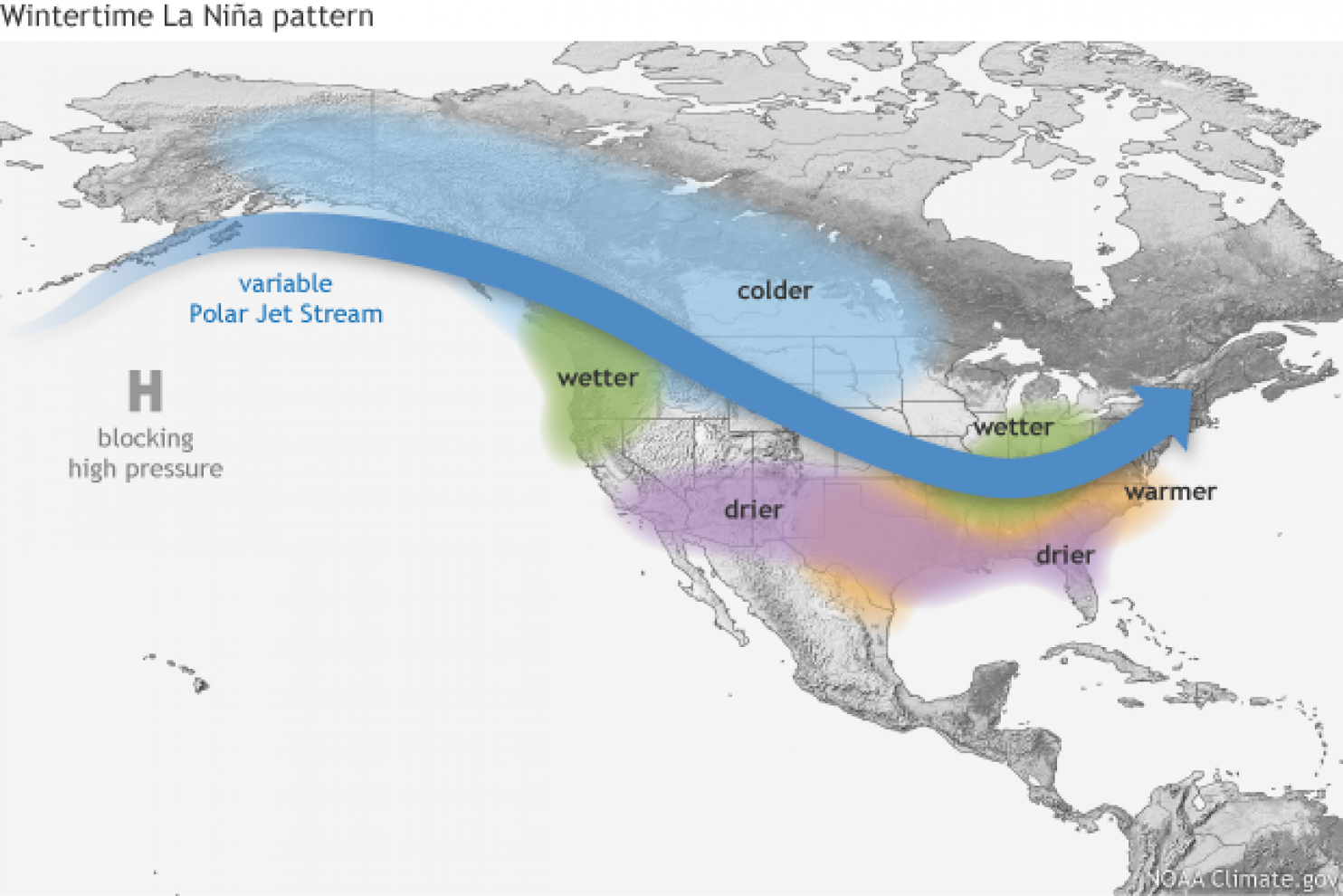
ENSO shifts irregularly back and forth between El Niño and La Niña every two to seven years. Each phase triggers predictable disruptions of temperature, precipitation, and winds. These changes disrupt the large-scale air movements in the tropics, triggering a cascade of global side effects.El Niño conditions occur when abnormally warm waters accumulate in tropical latitudes of the central and eastern Pacific Ocean. Consequently, tropical rains that usually fall over Indonesia shift eastward. During El Niño winters, northwestern North America is more likely to experience warmer-than average temperatures and the southeastern U.S. is more likely to receive more rain than average. La Niña conditions occur when cooler-than-average waters accumulate in the central and eastern tropical Pacific and tropical rains shift to the west. In the United States, seasonal precipitation impacts are generally opposite those of El Niño. Compared with El Niño conditions, La Niña conditions are generally more favorable for the formation of Atlantic hurricanes.
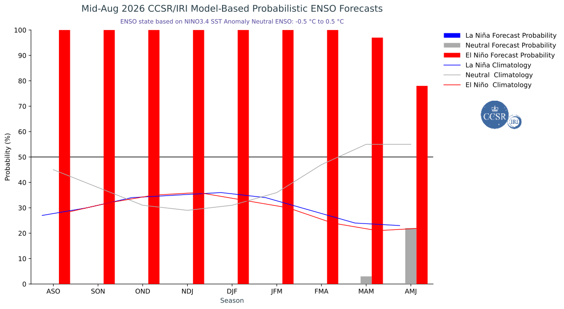
CPC/IRI Official Probabilistic ENSO Forecast
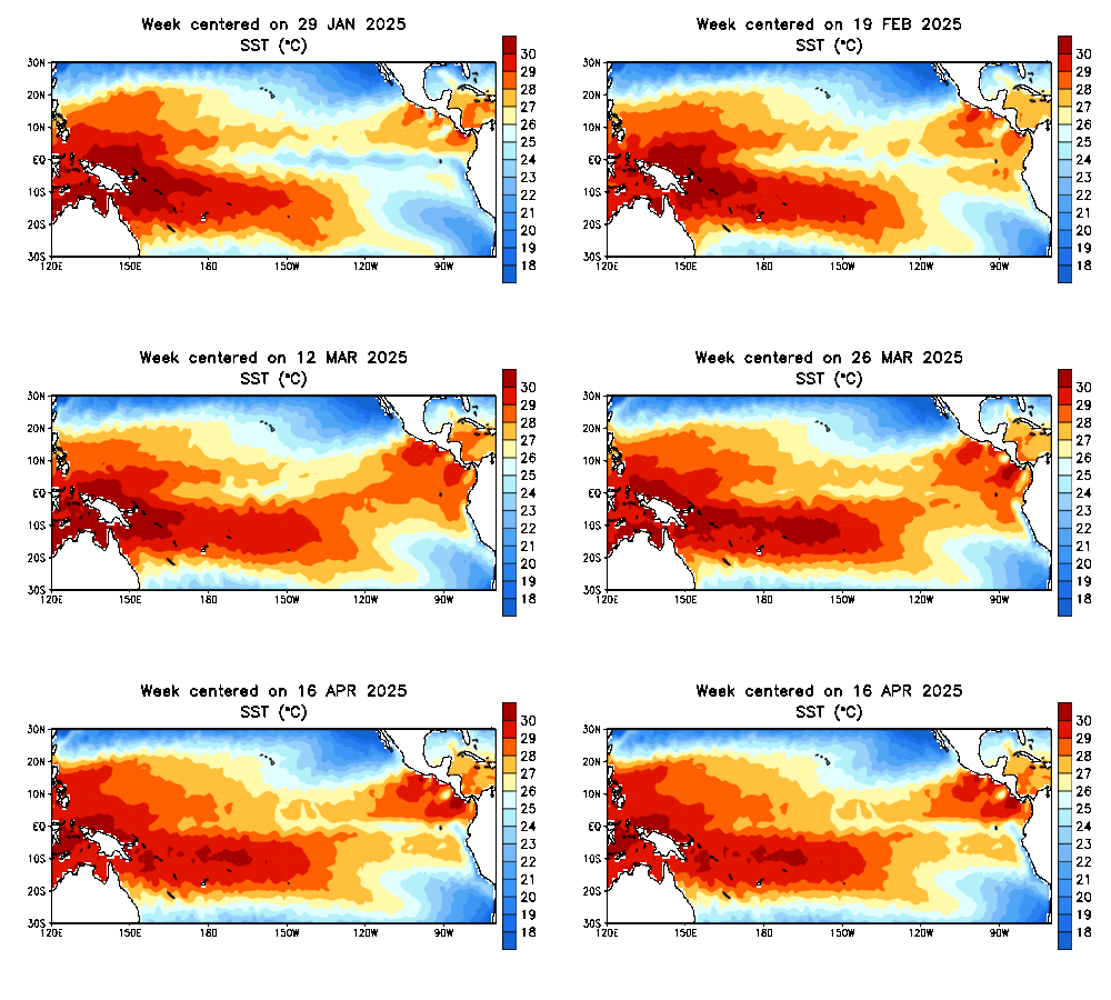
Sea Surface Temperatures (SST) Pacific
La Nina Winter Pattern
El Nino Winter Pattern